

WEEKLY DIGEST AND PLANNER NEWSLETTER
A weekly edition of weather related information in the First State

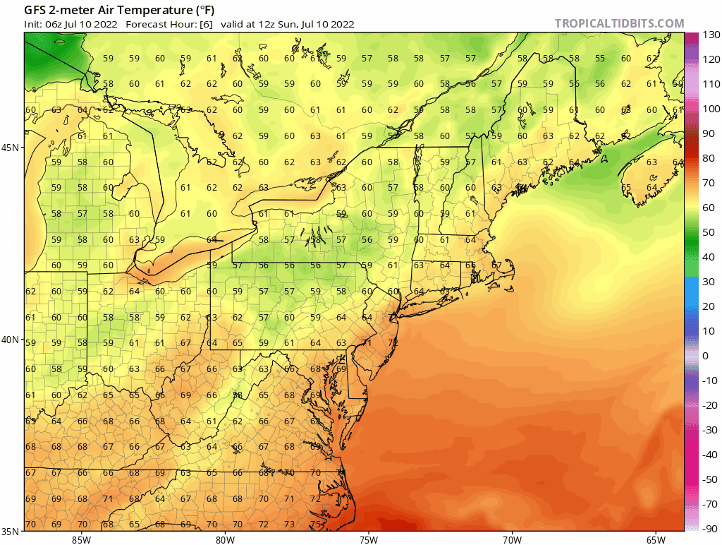
Are you ready for the “PAIN”? The “PAIN” of Summer is coming this weekend in the form of heat and humidity. A cold front approaches the area tonight which could touch off some showers, but the Heatmiser will be building with a high offshore which will PUMP hot air our way from the south. Below is the temperature depiction from the early run of the GFS. Anything dark brown to close to purple is really hot. Yet, this will be short-lived as Wednesday we get some relief when ANOTHER cold front sets up some T-Storms. Garden variety, nothing to sweat about (ha, ha).
The Midwest/West/Southwest
This is getting scary. I’m showing you two graphics. One is the temperature swings the middle of the country will be going through. The other is Precipitation anomalies (departure from normal) for the last month. Some of these places in Texas and Arizona are so hot and water restrictions for pools are in place that people don’t have enough water for their pool which is their only source of relief. There is just one big heat dome out there and it’s not getting better this week. Although in the Southwest they do have what is called a “Monsoon” season in New Mexico and parts of Arizona. Now, monsoon is not what you think. A monsoon is a seasonal, dramatic wind change. Along with that is some rain, but it’s been so hot and dry that the air is just sucking that moisture right out of the sky. It’s really bad and there are no fixes. You can’t fill the Colorado River with water from a garden hose, or the Brazos River in Texas. You just can’t. I feel for these people. And my brother who lives in Fort Worth, TX said you just can’t go out. The ground is so hot that even with shoes on the rubber soles just don’t protect your feet and you feel the heat. It’s like walking on coals.
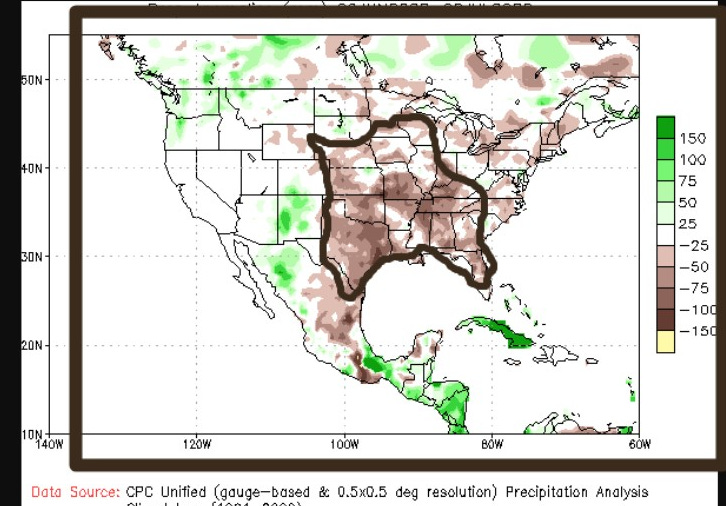
This is a precipitation anomaly chart. It is showing the departure from normal rainfall in millimeters. Look at the area I outlined. In one month (June 9th-July 9th) this area ran a deficit of -75 to -100 mm of rain. So, some places are 3-4 inches below normal for this time of the year.

This is the next 30 hours of possible temperatures in the Southwest and California. Look at the bright purples. That is 110 degrees F. The chart color scheme is to the right.
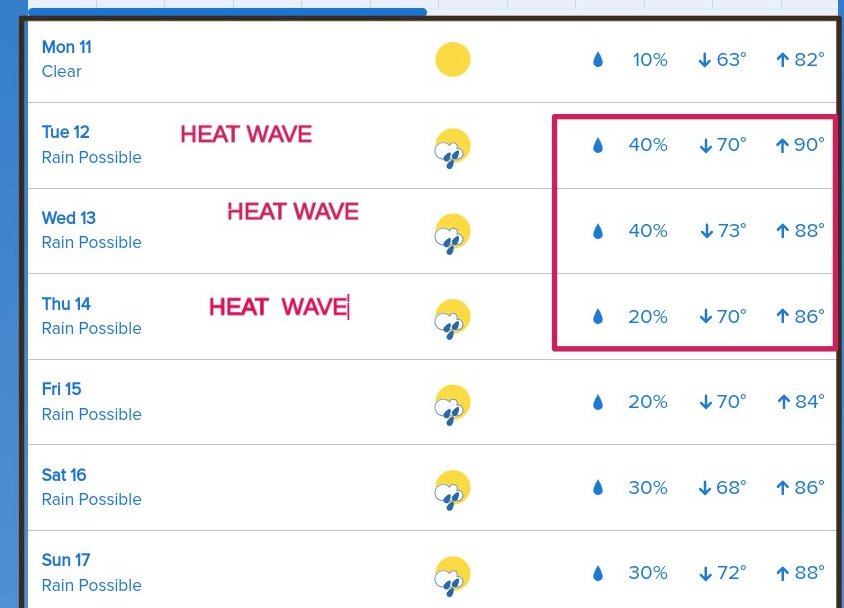
WEEK PLANNER
I’ve highlighted/marked three days next week as “HEAT WAVE” that’s because heat indices will be in excess of 90+ degrees. Dew points will shoot back up. That will make it feel hotter. Just hydrate and wear LOTS of sunscreens this week.
DELAWARE’S HIDDEN GEMS
Here are some places in Delaware where nobody would think of going and doing something but these are Quaint Villages of Kent County Check it out. There are lot of things to do!
