THE PV
The Polar Vortex has been, in large part, has been our culprit with this deep cold in the central part of the country and Eastern seaboard.

The Polar Vortex Isn’t a Buzzword Right Now — It’s the Pattern
The phrase “Polar Vortex” gets thrown around a lot, often incorrectly. But the recent cold across the United States has a very real connection to the vortex — not because of the name, but because of its placement, strength, and behavior.
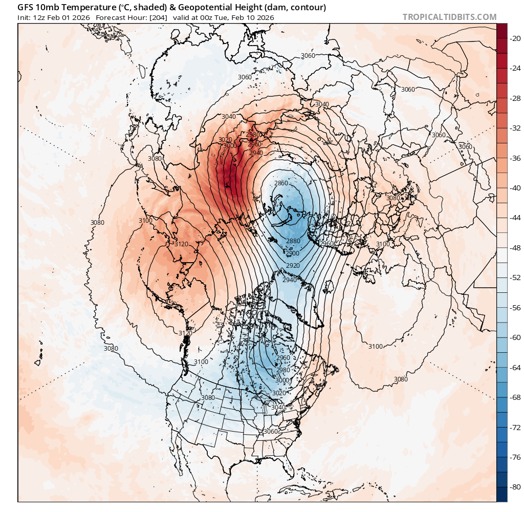
Several weeks ago, the Polar Vortex was displaced from its typical position near the pole. Instead of weakening into eastern Canada, the vortex elongated westward, allowing cold air to drain out of western Canada, cross the pole, and descend into the central United States. This cross-polar delivery is key — it placed the cold source directly over the heart of the country rather than offshore or confined to Canada.
Once established, the vortex exhibited a strong anticyclonic circulation near the pole, linking back through Eurasia and Europe before turning southward into North America. This configuration allowed repeated injections of Arctic air, even during brief periods when temperatures moderated.
Importantly, the vortex didn’t “disappear” during those warmer stretches. Instead, it temporarily weakened and stretched, allowing lobes of cold air to spill south again as atmospheric waves re-energized the pattern.
What Happens Next?
Model guidance over the next two weeks shows:
The Polar Vortex remains intact, but is

gradually weakening
A westward retreat of its core by mid-February
Short-lived moderation, not a pattern flip
This does not signal an early spring. While temperatures may rise at times, the broader hemispheric pattern suggests the vortex could re-strengthen for a final push late February into early March.
The Takeaway
This isn’t about hype or buzzwords. It’s about large-scale atmospheric structure and how cold is delivered across continents.
Expect:
Some moderation
No sustained warmth
One more reminder that winter controls the schedule