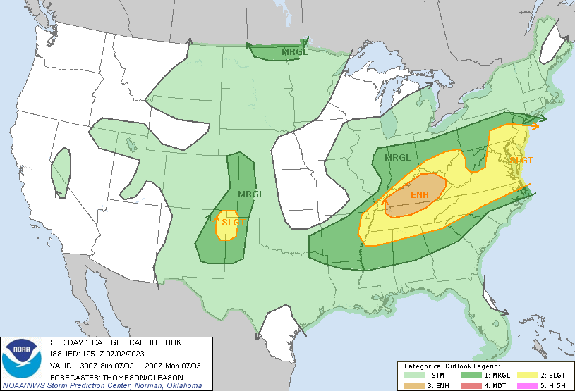
.This is the message from NOAA/SPC:

Mid-Atlantic this afternoon/evening...
   A weak surface trough immediately east of the Blue Ridge will help
   focus scattered thunderstorm development this afternoon from
   southeast PA across western MD and VA.  Midlevel flow will be
   stronger than previous days and sufficient for organized storm
   clusters, and perhaps some marginal supercell storms.  Though
   midlevel lapse rates will not be particularly steep, heating of the
   moist boundary layer (dewpoints in the low 70s) will drive MLCAPE of
   1500-2000 J/kg with steepening low-level lapse rates.  As a result,
   the stronger storms this afternoon/evening will be capable of
   producing damaging winds.
A Slight chance means there is a stronger possibility someone within the zone highlighted above will see some kind of severe weather.