

DWG: TRI-DI
Relaxed weather but the MAJOR HEAT is returning next week

Where do we begin? Let’s begin with the rest of this week. All should be relatively well and quiet. Temperatures will be warm, but not anything close to last week’s heat wave. And we have a chance of precipitation each day. I would gauge it at 30% very scattered, and spotty. It might happen in your area, but not in another. There is a chance of a system that is way back west to create some heavy thunderstorms later today/tonight, but no severe weather but, again, this will be spotty. These storms may fall apart and just not make it. We shall have to see! Here is a preview of the next few days on the GFS this morning:
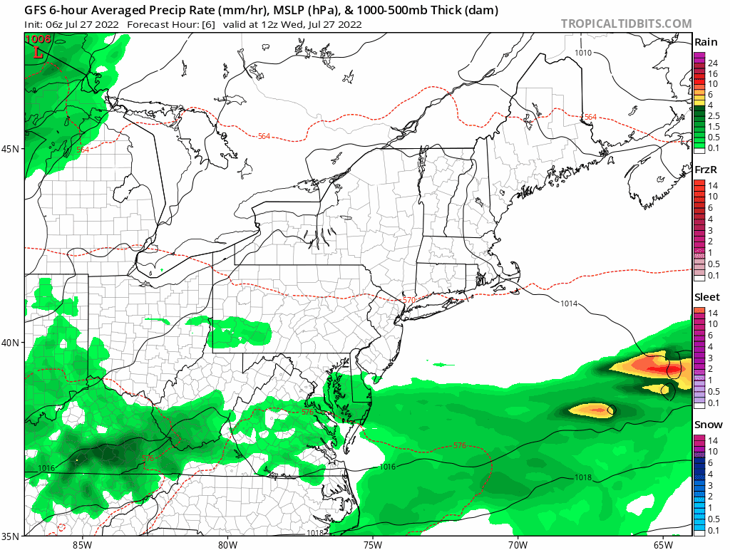
Source: Tropical Tidbits (Click For More Information)
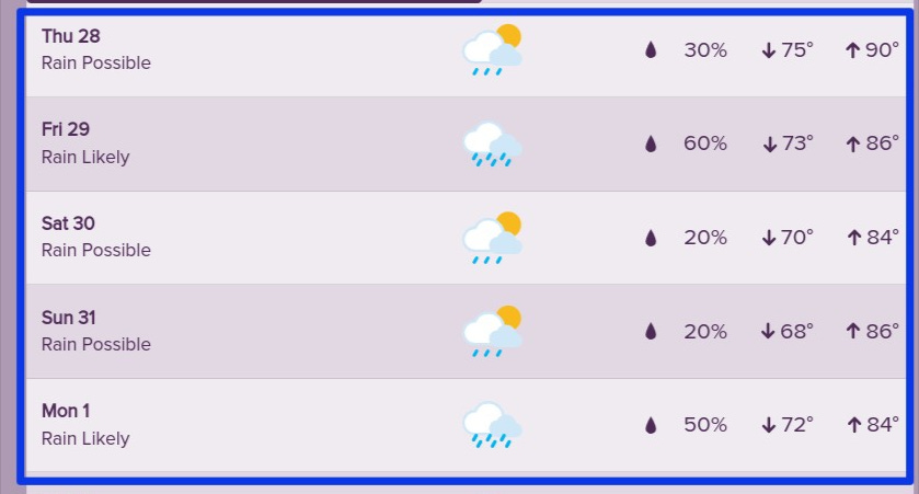
Week and Weekend Planner
THE HEAT RETURNS
This weekend we get a reprieve from what we experienced last weekend. Temperatures may flirt with 90 tomorrow(Thursday) but then come back down for the weekend.
The graphic shows you a 500MB chart in the upper atmosphere. This is about 18K feet above us. Brown/Orange colors alert us to “Ridges”, or high pressures which usually bring hot, or warmer weather than normal. And the blue colors alert us to “Troughs”. These are your areas that are colder/cooler than normal. And it normally translates to what is happening at the surface either hot, or cold; stormy, or quiet weather.
Anyway, do you see that large circle open wide over our area? That is a HUGE upper-level ridge height. This will mean HOT weather. This will match what we had last week, maybe even exceed it by a few degrees. This is for the weekend of 8/5. Be on the lookout!
