

DWG TRI-DI
Heat Wave Ends Tonight...Rain; hopefully, and we NEED IT!

The heat wave comes to a thankful end. Temperatures yesterday hit 95 air temperatures, but the heat index was over 103 degrees. My deck, outside the back, reached a surface temperature of 150 degrees. That’s no kidding or exaggeration. It was pretty intense.
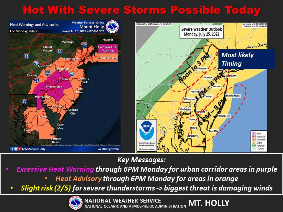
So, today is another heat excessive day as noted in the graphic but temperatures will be somewhat down since there are some pre-frontal clouds moving in. This will at least obscure the heat of the sun. It won’t have anything to do with humidity. Dew points will be well above 70 and humidity will be somewhere about 90%.
On the flip side of that encouraging information storms/cold front moving in will arrive somewhere between 3-6 pm. You can see the graphic on the right. The most severe aspect of the storms will be thunder, lightning, and some high winds.
Just watch the radar. Nothing out of the ordinary.
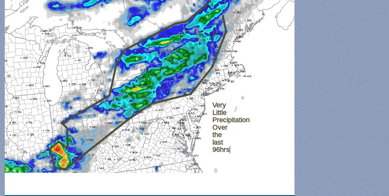
Over the last 72 hours, we have received little to no precipitation around the region except in areas north of Allentown. My front lawn looks pretty parched with brown spots all over it.