

DELAWARE WEATHER GUY: TRI-DI
HEAT WAVE AND UNSETTLED WEATHER MAINLY EASTERN PENNSYLVANIA


Temperatures will be pumped up for the next few days as we arrive at our first major heat wave. Tuesday through the weekend daily temps will be upwards of 90+ degrees with heat indices in the 100s. Combined with the heat and the winds coming from the south the factors to initiate severe storms will be ample.
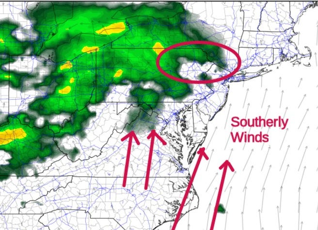
Starting this evening storms will be mostly firing up in most places in northern PA and northeastern PA. Some of those significant cells will filter down to our area late Monday night. The storms could contain supercells; however, more of the severe storms will be further north and east. The area I circled is a tornado threat area. You can see the Storm Prediction Center graphic showing the area of concern for today’s severe weather threat zone.
Be on the lookout!! Get your updates on the NOAA website!
